


lavandou la londe des maures

yoyo
User
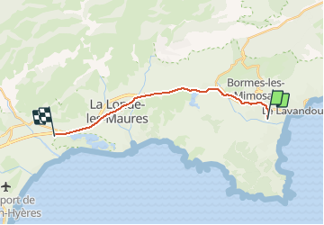

Length
15.5 km

Max alt
93 m

Uphill gradient
168 m
Km-Effort
17.7 km

Min alt
0 m

Downhill gradient
175 m
Boucle
No
Creation date :
2021-03-21 09:03:39.441
Updated on :
2021-03-21 09:06:57.02
--
Difficulty : Easy

FREE GPS app for hiking
 SityTrail
IGN / Geographical institutes
SityTrail Plus
The world is yours!
About
Trail Cycle of 15.5 km to be discovered at Provence-Alpes-Côte d'Azur, Var, Le Lavandou. This trail is proposed by yoyo .
Description
velo facile
Positioning
Country:
France
Region :
Provence-Alpes-Côte d'Azur
Department/Province :
Var
Municipality :
Le Lavandou
Location:
Unknown
Start:(Dec)
Start:(UTM)
284565 ; 4779083 (32T) N.
Comments